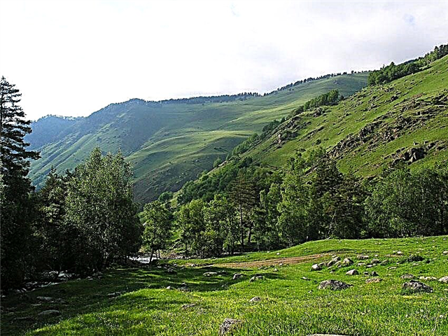
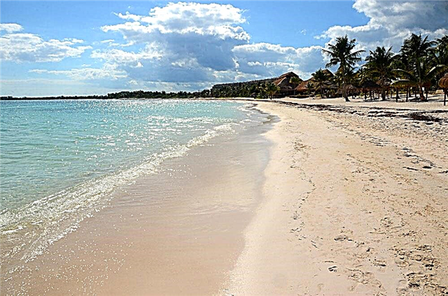
The rivers of the Chelyabinsk region are picturesque places, very heterogeneous in their appearance. The thickets of the forest here overnight can be replaced by rocky and even rocky areas or sandy valleys. In matters of tourism, reservoirs are practically not developed. There are no equipped beaches, the campgrounds and tents are prepared by visitors themselves, and rafting tours are also organized not by travel companies, but mainly by enthusiasts.
There is no industrial fishing on the rivers of the region. But there are areas with good biting, especially for dams and reservoirs formed right on the river beds. Some rivers pass through hunting grounds, so there is an opportunity to combine several types of recreation: hunting, rafting, fishing and nature observation.
The longest rivers of the Chelyabinsk region
Ural
The third longest river in Europe. It flows through Kazakhstan and three regions of Russia, including the Chelyabinsk region. It originates on the slopes of the Kruglaya Sopka, and flows into the Caspian Sea. The Urals are also a natural water border between Europe and Asia. There is even a memorial sign on the shore announcing this fact. In terms of tourism, the Ural valley is rich in natural beauty, rafting is organized.
The length of the river is 2428 km, in the Chelyabinsk region - 377 km

Ufa
The longest tributary of the Belaya passes through 3 regions, including the Chelyabinsk region. The banks are covered with mixed forests and thickets of bird cherry trees. Natural objects that attract tourists are rocks and caves, of which there are about 30 only in the area to Shemakha. The most interesting rafting routes are in the upper reaches. During the season, bream bites well here, as well as roach and dace.
The length of the river is 918 km, in the Chelyabinsk region - 245 km

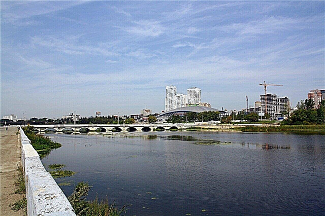
Miass
It originates in Bashkortostan and ends in the Kurgan region. The channel is not too meandering, in the upper reaches there are not only rapids, but also waterfalls. The river is regulated by dams, ponds and reservoirs have formed in the valley. Some are seasonal, others have been around for many years. Miass is one of the most polluted bodies of water in the country.
The length of the river is 658 km, in the Chelyabinsk region - 384 km

Ay
It originates in the Cranberry Swamp and is characterized as the most abundant in the region. On the banks there are outlier rocks, towering over the district, like giants. People come to Ai for pike, bleak, chub. A section of the river valley called Satkinsky has been declared a hydrological natural monument.
The length of the river is 549 km, in the Chelyabinsk region - 271 km

Uh
Border water body: for 250 km of its total length it flows along the border between Kazakhstan and Russia. The coast is covered with forest, which is interspersed with salt licks. These plots are not suitable for agriculture, therefore they are used for grazing livestock and making hay. After Troitsk, Uy diverges into the sleeves. Due to their mergers and intersections, islands are formed.
The length of the river is 462 km, in the Chelyabinsk region - 370 km

Yuryuzan
The translation of the name from one of the Bashkir dialects is “big river”. The source is located on the eastern slope of the Angular Mashak in Bashkortostan. The reservoir is crossed by bridges, including in Ust-Katava, included in the European route E30. A protected area stretches from the Smirnovsky Bridge to the mouth of the Nasi River - a hydrological natural monument.
The length of the river is 404 km, in the Chelyabinsk region - 180 km

Techa
In addition to the Chelyabinsk region, it also flows in the Kurgan region. The source is the Irtyash lake-reservoir. In the last century, the river was exposed to radioactive contamination. Its consequences have not yet been overcome. Some of the settlements had to be resettled. Fishing is prohibited, along the coast there are areas fenced with barbed wire. Shrubs and other protective vegetation are also planted here.
The length of the river is 243 km, in the Chelyabinsk region - 140 km

Sim
The right tributary of the Belaya also flows through Bashkortostan. The pool is divided into mountainous and flat areas. Representatives of the Red Data Book species live near the reservoir, including the oystercatcher. There is a problem with pollution due to runoff waters of enterprises. On the coast of Sim near the village of Serpiyevka is the Ignatievskaya Cave - a cultural and natural monument of world importance.
The length of the river is 239 km, in the Chelyabinsk region - 119 km

Uvelka
It is the largest tributary of the Uy River. A camp of people who lived in the Stone Age was discovered near the village of Kichigino. There are other archaeological sites along the coast, including burials from different eras. The best place for fishing on Uvelka is the Yuzhnouralsk reservoir. It was formed during the construction of the state district power station. The valley is densely populated. There are jasper outcrops on the coast.
River length - 234 km

Gumbeyka
The left tributary of the Urals belongs to the 3rd districts of the region. It originates in the Urlyadinsky mountains and flows into the Urals near the Ablyazovsky meadows, recognized as a natural monument. If summer is dry, then Gumbeyka grows shallow, drying out in places. It is more full-flowing in the upper reaches, although the vast majority of rivers are in the lower. The cleanest coastal zone stretches from the source to Ferschampenoise.
River length - 202 km

Karataly Ayat
Steppe river, the depth of which generally does not exceed a meter. Seasonality greatly affects the water level: it spills in the spring, dries up in the summer. There are ponds on the river, and the largest of them is the Popov Brod reservoir. In the upper course, the channel passes through the natural monument Karagaysky Bor. Ayat karatals attract zoologists and ornithologists: it is convenient to observe birds and animals here.
River length - 175 km

Sintashta
This is the name of the Kazakh river Zhelkuar in the upper reaches. Sintashta is one of the tributaries of the Tobol. The main attraction of the reservoir is on the right bank. Archaeological sites of the Bronze Age have been discovered here. The large burial ground contains 40 graves. Since horses and valuables were buried along with the dead, many curious artifacts were found.
The length of the river is 152 km, in the Chelyabinsk region - 105 km

Sinara
The northernmost river of the region. In addition, it is partially located in the Sverdlovsk and Kurgan regions. The source is the lake of the same name, and the mouth is the Iset River. The channel width ranges from 12 to 40 meters. 10 inflows contribute to the creation of an extensive network of rafting routes. Difficulty is different: in some parts of the channel there are many turns and rifts. The shores are covered with low vegetation.
The length of the river is 148 km, in the Chelyabinsk region - 107 km

Toguzak
Like the Uy, to which the Toguzak is a right tributary, it belongs to the border water bodies. The channel crosses the border with Kazakhstan three times. The main part flows through 4 districts of the Chelyabinsk region. The river actually has three sources: including the swamp near the village of Paris. Small streams merge together near the village of Alekseevka and become Toguzak. It is part of the Irtysh river basin.
River length - 131 km

Big Karaganka
Disputes about the origin of the name do not subside, therefore there are several versions of the translation, including “black water” and “black blood”. The channel runs along a rift, so esotericists attribute to Big Karaganka the ability to saturate people with energy. Clay and mud are used by local people to treat skin diseases. Typical catches on the river are ide and perch.
River length - 111 km

Katav
It begins and ends in the Chelyabinsk region, but "enters" the territory of Bashkortostan, where it flows for 16 km. Due to the abundance of rapids and the fast current, extreme people come here for rafting. Ponds formed on the riverbed. They are especially rich in fish. Maryin ute allows you to camp and see the local beauty from a hill.
River length - 111 km

Zingeyka
It is completely within the area. It flows through the lands of the Katsbakh hunting farm.Waterfowl, as well as hares and foxes are shot here. Fishermen return home with a good catch, where perch predominates. There are no rest houses and refined beaches on the shore, but there are places to set up camp. The sights of the area are Kamenny Log and Vorovskaya Gora.
River length - 102 km

Sanarka
Left tributary of the Uy River. The low banks are covered with thickets of reeds. Sanarka has changed in recent years. Silt at the bottom is more and more, algae tighten the coastal zones. All this affects the speed of the current: the river is almost standing. The area takes on the features of a swamp. Fishing is possible only in some areas and mainly from boats. Abandoned mines can be found along the coast.
River length - 90 km

Boar
The Uvelka tributary passes through the central part of the region. There are dams built on the riverbed, which contributed to the formation of large ponds. The boar is fed by 7 tributaries. In the upper reaches, the area is swampy, in the lower reaches, the shores are heterogeneous: forests are replaced by plains or rocky zones, resembling gorges. The best bite is at the Black Ford. The natural attraction of the river valley is Demarinsky Bor.
River length - 85 km

Bagaryak
It also flows through the Sverdlovsk region. The current is fast, rifts are found everywhere. Due to the soil, the water turns crimson. Rafting tours are organized mainly in the spring. By autumn, the level of Bagaryak drops significantly: the river can be wade. Recreation centers have been opened, for example, "Birch". The best bite is on the Averinsky pond. But you have to pay for fishing.
The total length of the river is 80 km

Kurasan
The river belongs to the lands of 3 districts of the region. It flows into Uy and belongs to the Irtysh river basin. It is best to go here by off-road vehicles to avoid problems on rough terrain. You can see the waterfall and other natural beauty. There are several settlements on the coast. Kurasan is fed by a dozen tributaries, some of which are more like streams.
River length - 79 km

Karabolka
It originates near the Bugai swamp. The name translates as "dark or clear". Low shores alternate with sheer cliffs. Vegetation near the water - alder, willow, bird cherry. Ice drift takes only a few days. Karabolka in the area from the village of Ust-Karabolka to the mouth is recognized as a hydrological natural monument. Part of the river has been contaminated by radioactive contamination.
River length - 76 km

Ufaleyka
In the past, the right tributary of the Ufa was used as a trade route. Wooden pedestrian bridges are thrown across the riverbed. Thanks to them and settlements that come right up to the water, some parts of the river look especially picturesque. Ufaleyka is used to provide water to neighboring villages. There are not very many fish, but there is a chance to catch roach, burbot and pike.
River length - 70 km

Zyuselga
The translation of the name is “intermittent” or “spring”. One of the longest tributaries of the Miass. Zyuzelga is used to provide nearby villages with water. Amateur fishermen meet on the shores all year round. There is no need for a boat. The channel runs through the territories of hunting farms. With a license, you can shoot moose, hares, muskrats and wild boars.
River length - 65 km

Asha
The right tributary of the Sim begins on the slopes of the Karatau. It is a natural monument and in the upper reaches it flows through an uninhabited valley. In the past, lumberjacks lived here. Now the main damage to the terrain is done by vacationers. Since Asha is formed from mountain springs, the water in it is clean and always cool. The bottom is rocky, and on the coast there are caves, grottoes, hills.
River length - 59 km