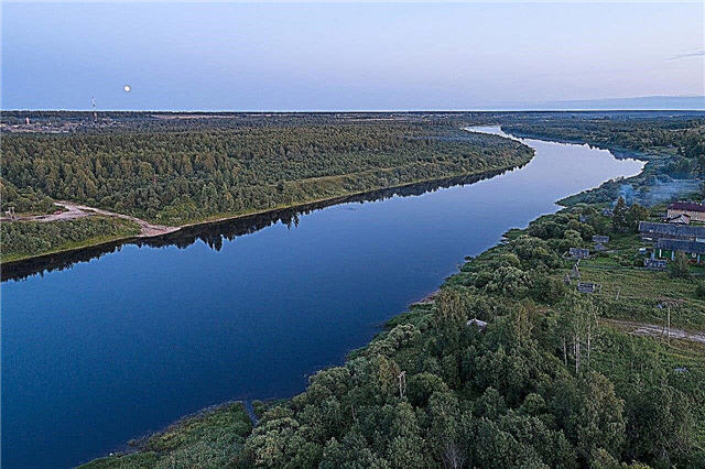
The water resources of Arkhangelsk and the region are unique. More than 2000 of them are more than 10 km long. Large rivers are navigable; cities and large villages are located on their banks. But most of the rivers originate in wetlands and flow in taiga forests. It is on the banks of these rivers that one can appreciate the true beauty of northern nature. Basically, the rivers of the Arkhangelsk region are not deep, have a sandy bottom and a calm flow. The fast flow is typical for the rivers flowing in the west of the region and near the Timan ridge.
Most of the region's rivers are suitable for rafting, both kayaking and rafting. Most often, organized rafting tours are organized along the Onega and Northern Dvina rivers. The direction of educational tourism is interesting - ancient churches and monasteries have been preserved on the banks of many rivers.
The longest rivers in the Arkhangelsk region
List of the largest rivers flowing through the region.
Vychegda
Tributary of the Northern Dvina. A drifting and navigable river, however, it poses a danger to kayakers with a strong current and a large number of bends. This creates rotational movements that form a whirlpool that can pull in depth. Moreover, the maximum depth of Vychegda is 2 meters. Vychegda flows through the territories of the Komi Republic and the Arkhangelsk region.
The length of the river is 1130 km, in the Arkhangelsk region - 226 km.

Mezen
The river has a record number of tributaries - more than 15,000 streams, small and medium rivers. There are no recreation centers and other tourist infrastructure on the river. This creates an excellent opportunity for a relaxing holiday in nature. Lovers of kayaking often come to the Mezen River. They are attracted by a large number of rapids and rapids. Mezen flows through the Arkhangelsk region and the Komi Republic.
The total length of the river is 966 km.

Pinega
The picturesque nature of the Pinega shores will not leave anyone indifferent. Travelers appreciate its serene and austere beauty. In addition to tourists, speleologists often come to this region. They are attracted by karst caves, some of which are several kilometers long. The caves are hundreds of years old. Also on the banks of the river there are many monuments of ancient ancient architecture.
The length of the river is 779 km.

Northern Dvina
A flat river with many islands and rifts. Tourists in this place will see a rare natural northern beauty among pine and spruce forests, rich in mushrooms and berries. On the banks of the river, tourist bases have been built and campsites have been equipped. An excursion route on an old motor ship runs along the river. The Northern Dvina flows through the Arkhangelsk and Vologda regions.
The total length of the river is 744 km.

Vashka
Mezen tributary. In the place of their confluence, the village of Leshukonskoye is located. It flows among coniferous forests. In the upper reaches of the river there is a unique pine massif - the Korabelnaya Chascha or Prishvinsky Bor nature reserve. It is in these places that the banks of the river are most picturesque. Vashka is a navigable river. In its waters are found perch, ide, bream, grayling, peled. Vashka flows through the territories of the Komi Republic and the Arkhangelsk region.
The total length of the river is 605 km.

Waga
The source of the river is located in a swampy area. But mainly Vaga flows through coniferous forests. There are many meadows in the lower reaches of the river. The opportunity to relax in the fresh clean air is very much appreciated by the guests of these places. The bottom of the river is sandy, with the exception of the valley near the mouth of the Regi. In these places, the coastal slopes reach 50 meters in height, and the bottom is rocky and pebble. The Vaga flows through two regions - Arkhangelsk and Vologda.
The total length of the river is 575 km.

Onega
The river flows out of Lake Lacha. That is why Onega is full-flowing throughout its entire length. Flowing along the plain, it forms stretches reaching a width of 40 meters. There are rapids and rifts on it, but they are not dangerous. Therefore, rafting on it is not difficult even for beginners. A water trip along Onega is a great opportunity to appreciate the beauty of ancient cities and northern nature.
The length of the river is 416 km.

Cubena
A winding river has a fast current. Its banks are covered with dense forests. There are also sandy areas that are great for beach recreation and swimming. An excursion along the river will be of interest to different categories of travelers - lovers of northern nature, pilgrims - after all, there are many holy places on the banks of the Kubena and fans of ancient villages. It flows through the Arkhangelsk and Vologda regions.
The total length of the river is 368 km.

Pesa
Formed by the confluence of two rivers on the Timan Ridge. The winding river bed passes through coniferous forests, part of the river bed is swampy. The river is navigable practically along its entire length. Several small towns and villages are located on its banks. Pike, grayling and perch are found in the river. In the Komi language, the name of the river means "pine". There are interesting steep red shores on Pöse.
The length of the river is 363 km.

Villed
A flat river, which is a tributary of the Vychegda. Most of the river banks are covered with forests, and only 2% of the river basin is swampy. The willow is attractive to fishermen - it is home to a large number of different species of fish. The channel width reaches 20 meters. In the upper reaches of the river banks are not inhabited, there are settlements in the middle of the river. Viledi tributaries flow from the Komi Republic and the Kirov region.
The length of the river is 321 km.

Yarenga
The inflow of the Vychegda. A beautiful taiga river with a fast flow in the upper reaches. Part of the river passes through the Yarensky reserve. The area of the river basin is considered ecologically clean. The high banks of the Yarenga are impassable - they are covered with bushes and dense forest. There are also sandy shores with cliffs. It flows through the territories of the Arkhangelsk region and the Komi Republic.
The length of the river is 281 km, in the Arkhangelsk region - 201 km.

Voloshka
Tributary of the Onega River. Used for rafting and fishing. It is inhabited by burbot, soroga, chub, ruff, perch. The river water is “moderately polluted”. The population of the villages on its banks use the river water for domestic and economic needs, thereby polluting and littering it. Voloshka has mainly snow supply; during the spring flood, 67% of the runoff passes. The river opens up in late April or early May.
The length of the river is 260 km.

Kokshenga
The name of the river in the Mari language means "dry river". In the upper reaches, its width on average ranges from 30 to 40 meters. After the confluence of three large tributaries, the width of the river reaches 60 meters. In these places the flow of the river is slow, there are many bays and oxbows. In the lower reaches, the course of the river becomes faster, rapids and rocky rifts appear. It flows through the Arkhangelsk and Vologda regions.
The total length of the river is 251 km.

Yula (tributary of the Pinega)
The beginning of the river is in the Verkhoyulsk bog. Belongs to the river basin of the Northern Dvina. In the upper reaches of the Yula there is a winding channel, which becomes rectilinear after the confluence of the Borovaya tributary into it. The height of the steep banks of the river can reach 20 meters. The bottom of the river is rocky, occasionally there are large boulders, there are small rapids. In Yulia, grayling, perch, whitefish, salmon, pike are found.
The length of the river is 250 km.

Uftyuga
The banks of the river are covered with forest and poorly populated. There are only a few villages along its entire length. The upper reaches of the river flows through the Uftyugo-Ileshsky nature reserve. Ufyuga is a flat river with a weak current. Its channel is winding. There are straight sections only in the middle reaches. The width of the river in the upper reaches is on average from 7 to 10 meters, in the lower reaches 115 meters. Uftyuga is used for timber rafting.
The length of the river is 236 km.

Mezen Tansy
It begins on the Chetlassky Kamen hill in one of the spurs of the Timan ridge. This is a swampy area, which downstream of the river gives way to forests with few lakes and meadow vegetation.At the confluence of one of its tributaries into the Mezenskaya Pizhma, there is a landscape nature reserve - Ust-Chetlasky. The river flows through the Arkhangelsk region and the Komi Republic.
The total length of the river is 236 km.

Kuloi (tributary of the Vagi)
It flows through the taiga forests. Water travelers celebrate the peace and quiet of these places. Rare tourists most often come to appreciate the beauty of the Zaozersky reserve, through which the Kuloi flows. Translated from the Sami, the name of the river means "fish river". It really is home to different types of fish, you can catch large specimens of pike and perch. It flows through the Arkhangelsk and Vologda regions.
The total length of the river is 206 km.

Vel
The river is suitable for rafting on catamarans and kayaks, travel along the river is not particularly difficult. The river is also interesting for fishermen. Its waters are inhabited by roach, pike, grayling, peled, and perch. In the upper reaches, the river valley is poorly expressed, the banks are swampy and wooded. In the middle course, the river becomes wider, the channel becomes meandering. In the lower reaches, the valley narrows again, and the shores become more populated.
The length of the river is 223 km.

Sula (tributary of the Mezen)
The river is not popular with tourists and water travelers. Those who want to appreciate the pristine and amazing northern nature come here. In the forests on the banks of the Sula, there are many mosquitoes - which is worth remembering for independent travelers. There are also large dangerous predators in the forests. The source of the river is in the marshy area of the Timan Ridge. The river feeds on snow water.
The length of the river is 221 km.

Kyma
There are excursion bureaus that organize rafting on the Kyma. They carry out the transfer of tourists and provide the necessary equipment - from tents to hiking baths. Therefore, a water trip along this beautiful and calm river is suitable not only for independent travelers. There are also organized tours especially for fishermen. They are taken to fishing in lure places.
The length of the river is 219 km.

Vizhas
The source of the river is a small lake called Vostochnoye Bykovo, its mouth is the Czech Bay in the Barents Sea. The banks of the river began to be built up only in the 18th century. Mostly Old Believers who were hiding from persecution settled here. The banks of the river are covered with low vegetation - thickets of willow, birch and small firs. Above the river, the small-growing forest becomes a dense forest. Vizhas forms several small lakes.
The length of the river is 219 km.

Vaenga
It is a tributary of the Northern Dvina. In the Chud language, the name of the river means "magic river". In the upper course, the river flows through the marshy area and the Klonovsky reserve, there are many rapids and rapids, the bottom is rocky. At the same time, the width of the Vaenga in the upper reaches of the river does not exceed 15 meters, and in the lower reaches it reaches 55 meters. Perch and grayling are found in the river. There are many villages on the river, including abandoned ones.
The length of the river is 218 km.

Ilyosha
It is a right tributary of the Pinega River. In the upper reaches it is called Malaya Ilesha and is part of the Uftyugo-Ileshsky reserve. Its shores are sparsely populated, the largest settlement is the village of Krasnaya, which is home to about 500 people. The tributaries of the Ilesha are Koda, Pyshega and Pinega Yontala. The river is fed by rain and snow waters. It flows through the Arkhangelsk region and the Komi Republic.
The total length of the river is 204 km.

Emtsa
Formed by the confluence of the rivers Krestovaya and Rezhma, the source is located in a highly swampy area. The middle course of the river passes through the closed administrative district of Mirny. Travelers are interested in river rafting and fishing. Various types of fish are found in the river, especially crucian carp, bream and perch. The water in the river is highly mineralized. Yemetsa flows through beautiful places to which there are many access roads.
The length of the river is 188 km.

Vyya
It is a left tributary of the Pinega River. It flows in the lowlands among the low hills. The nature here is beautiful with natural beauty. These places are practically not affected by logging and industrial activities. The air is clean and fresh, which attracts tourists here. The tributaries of the Vyi are bumpy streams and small rivers reaching a length of 60 km. Partially, the Vyya river basin is located in the territory of the Dvinsko-Pinezhsky forest.
The length of the river is 188 km.

Zolotitsa
Tourism on the river is poorly developed, even among independent travelers. In the plans of some organizations there is a revival of the salmon population, which can lead to an increase in interest in this river. Currently, fans of amateur fishing are interested in pikes, perches, burbot and roach living in Zolotitsa. On the banks of the river there is a large diamond deposit and the shift workers' settlements formed around it.
The length of the river is 177 km.

Verkhnyaya Lupya
A small river flowing through a dense forest. Among the pine forest there are also sections of beach shores. The river bed is not wide. Fallen trees sometimes completely block it, there are rocky rifts. This makes rafting on it very difficult. Fishermen talk about good fishing in Upper Lup'e. It is inhabited by grayling, perch and pike. It flows through the Arkhangelsk region and the Komi Republic.
The total length of the river is 175 km.

Kimzha (tributary of the Mezen)
Formed by the confluence of the rivers Verweil and Viska. The village of the same name on its banks has been included in the Association of the Most Beautiful Villages of the Country since 2016. It is located near the confluence of the Kimzha and the Mezen. Every year a major holiday is organized in the village. The views of the river are beautiful and picturesque. Its winding channel among forests and meadows will appeal to many tourists. The river is rich in fish - pike, grayling, ide and perch.
The length of the river is 158 km.

Waimuga
A small river in the upper reaches, which further becomes full-flowing and wide with a pronounced valley. Steep banks are replaced by gentle ones. At the source in Lake Obozero, the river has a fast current, the bottom of the river is rocky, the banks are gentle and low. The river is suitable for kayaking along the entire length, as well as for fishing. In the upper reaches, grayling is best caught, in the middle and lower reaches - pike and whitefish.
The length of the river is 152 km.

Big Churga
It is a tributary of the Vaga. The source of the river is located near the village of Semenovskaya in the swamps. The river winds strongly along its entire length, forming many whirlpools. The average width of the river is 15 meters, the depth is 1-1.5 meters. Clay and sandy shores are overgrown with dense larch and coniferous forests and small shrubs. There are few places for swimming on the river. The settlements on the river are located in its lower course.
The length of the river is 121 km.


