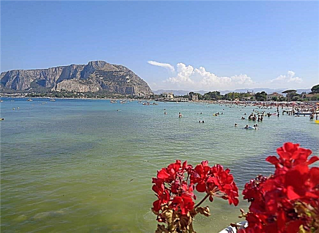
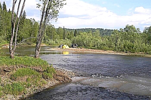
All the rivers of the Kemerovo region belong to the basin of the great river of Siberia - the Ob. Most of the Kuzbass rivers flow from south to north. Rivers are a wealth given to us by nature. The rivers of the region are divided into three types: mountainous, flat and mixed. Plain rivers calmly roll their waters through fields and forests. These rivers are navigable.
The total length of all rivers in the region exceeds 245 thousand km. The number of the largest rivers is about thirty. The region is dominated by floodplain lakes formed in the floodplains of rivers. Most of the region's rivers begin in the mountains of the Salair Ridge, on the western and northern slopes of the Kuznetsk Alatau. Kuzbass is also rich in mineral springs: Tersinka, Borisovskaya, Borzhomi.
The longest rivers of Kuzbass
List, photo with the names and descriptions of the main rivers of the Kemerovo region.
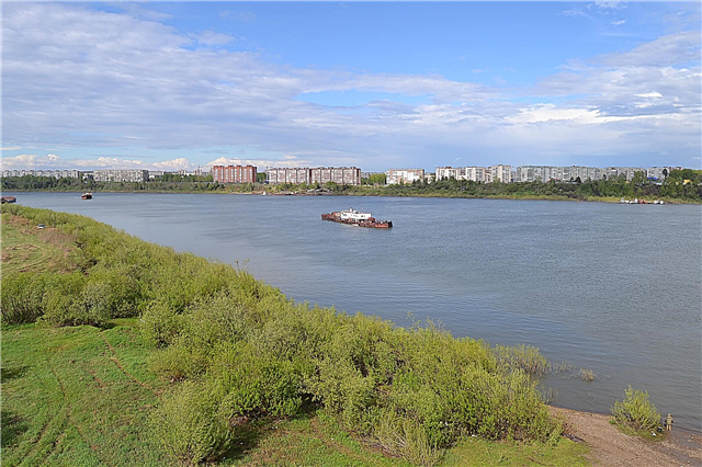
Tom
It takes place not only in the Kemerovo region, but also in the Tomsk region. The source of the r. Tom is located near the Abakan ridge. In the upper reaches of the Tom, there is a transparent, wide and fast river, in which there are many fish. The river is fed mixed. The river is under the ice from November to April. About a dozen enterprises consume water from Tom. In the past two decades, the river has become shallow. In Novokuznetsk and in the region, the motor ship no longer runs along the river. Only motor boats and boats pass by. The Kemerovo-Tomsk section is served by motor ships.
The length of the river is 827 km, in the Kemerovo region - 596 km

Inya
A typical flat river with many branches, islands and old channels. It flows in the Kemerovo and Novosibirsk regions. It flows into the Ob on the right downstream. The source of the river is located on the Taradonovsky Uval. On the Ina, there is the Belovskoye reservoir, where they offer scooters for rent, silver carp and other fish.
The length of the river is 663 km, in the Kemerovo region - 443 km

Kiya
"Kiya" in translation from the Turkic means "rocky cliff". The source of Kii is located on the Chemodan and Medvezhiy Loch mountains. The banks of the Kia are very beautiful rocky, covered with mixed forests. There are no industrial enterprises on the banks of the Kiya. Therefore, the river managed to preserve its pristine purity. There are many beautiful waterfalls on the river. In the lower reaches, the river flows through the neighboring Tomsk region. Chulyma is the main tributary of the Kiya River.
The length of the river is 548 km, in the Kemerovo region - 468 km

Condom
It is a left tributary of the Tom. The source is located on the Biyskaya Griva ridge. In the upper part, the river mouth is rocky, the current is fast. The condom flows only through the Kemerovo region. In the middle and lower reaches of the Kondoma there is a flat river: it flows slowly from village to village, from village to city. In the last century, there were gold-bearing veins on the river. Nowadays, the river is an excellent place for recreation and fishing. Within the city of Novokuznetsk, you can ride a rented rowing boat along the Kondome River.
River length - 392 km

Yaya
Yaya flows into the Chulym River on the left. The source of the river is in the mountains of the Kuznetsk Alatau. Yaya flows through the Kemerovo and Tomsk regions. The river can be divided into three sections. In the upper part, the current is fast: the river flows down from the mountains. In the middle course, the river runs more slowly. The bottom of the river becomes sandy. And the upper reaches the bottom is covered with sharp stones. In the XIX-XX centuries, gold was mined on the Yaya River. In the lower reaches of the Yaya it is suitable for sailing. There are fish in the river: pike, perch, ide.
The length of the river is 380 km, in the Kemerovo region - 218 km

Mras-Su
The left tributary of the Tom, flows along the Gornaya Shoria. The river with clean water, rough, is famous for the Khomutov rapids (5 km long, seven cascades). The river has the III category of difficulty. The speed of the river in some places reaches 20 km per hour. Semi-abandoned villages and forests are located along the banks. Used for timber rafting. The river is attractive to tourists.
River length - 338 km

Uryup
The source of the river is located at the Kuznetsk Alatau in Khakassia. The river, in the upper reaches, serves as the border of Khakassia and the Kemerovo region. The water in the river is very clean, it runs merrily from the mountains. In the upper course, the river is shallow. There is a lot of driftwood piled up. Fishing on Uryupa is very good. The places are not very visited by fishermen. Everything from Taimen to perch is found here. Many beavers live in the river. There is a fur-bearing animal - a mink. And there is no city of Uryupinsk on the Uryup River. It is located in the Volgograd region.
The total length of the river is 223 km

Golden Kitat
The source is located in the Kuznetsk Alatau. Golden Kitat is a tributary of the Yaya River. In the 19th century, gold was mined on the river. The river is not deep and crystal clear, the banks are rocky. River of the 1st category according to the complexity of rafting in flood. Gradually, the river from the mountainous area goes into the forest-steppe. There are two settlements in the lower reaches of the river.
River length - 185 km

Usa
The source is located at the Kharykh Taskhyl mountain in the Kuznetsk Alatau at an altitude of 1686 meters above sea level. Usa flows into the Tom on the right. The city of Mezhdurechensk is located at the mouth. There are three rapids on Usa: Bazansky, Shataisky, Snotly. The river is of interest for rafting and all types of fishing: with a float, for bottom fishing, fly fishing, for spinning. Grayling, burbot, lenok, taimen and more are caught.
River length - 179 km

Kara-Chumysh
Kara-Chumysh and Tom-Chumysh, merging together, form the Chumysh River. A dam was built on the Kara-Chumysh River in 1953. A large area was under water. The reservoir is called “Kara-Chumyshskoe”. It serves to supply water to the city of Kiselevsk. Along the banks of the reservoir there are rocky mountains and mixed forest. Kuzbass people like to relax in these places, where there are recreation areas, beaches, you can ride boats, horseback, and fish.
River length - 173 km

Shroud
It flows into Kiya on the left side of the river. The source is located on the northern slopes of the Kuznetsk Alatau. Kozhukh is a shallow river with a rocky bottom, located in the Tisulsky district in the north of Kuzbass. On the river there was a village of the same name. Here, in the deep taiga, lived "chemists" sentenced to a settlement. It is difficult to reach the river off-road: you cannot do without a winch. The terrain is swampy, around bear footprints, horseflies.
River length - 144 km

Mundybash
The source of the river is located near Mount Mustag in Gornaya Shoria. Mundybash flows into Kondoma on the right. The river has a calm flow, in some places there are rifts. In winter, Mundybash is covered with ice, like all Siberian rivers. In spring, during floods, the river has the I category of difficulty for water tourism. The water is cloudy. On May Day holidays there is a traditional spring rafting of local water tourists along Mundybash. Fifteen species of fish are found in the Mundybash River: taimen, grayling, pike and others.
River length - 120 km

Average Ters
Right tributary of the Tom. The source is located near the Kruglaya Mountain Kuznetsky Alatau western slopes. The river is taiga, mountainous. The water in the river is cold and clean. The current is fast. It flows in a narrow valley with high banks. The village of Mutny is located on the shore. From the 19th to the beginning of the last century, there was a gold mine on the river. Currently, the Sredny Ters is one of the best rivers for recreation and fishing.
River length - 114 km

Tydon
Right tributary of the Tom. The source is on Mount Pestraya in the Kuznetsk Alatau. Taidon is a mountain river flowing between the Saltymakovsky and Tydyn ridges. The bottom is rocky. The water in the river is cold and you can drink. On the shore is the village of Medvezhka, built by exiles. From the village, through a checkpoint, you can get to the Kuznetsky Alatau reserve. The places are hard to reach.
River length - 110 km

Barzas
Right tributary of the Yaya. The banks of the river are steep. The river is meandering. On the banks of the Barzas River, there is the city of Berezovsky, the Barzas State Reserve In 1929, a seam of sapropel coal, a raw material for the chemical industry, was found in the region of the river. This is how the village of Barzas appeared. The banks of the river are swampy, overgrown with willow. Grayling and pike are found in the river.
River length - 110 km

Nizhnyaya Ters
Lower Ters is the right tributary of the Tom River. Mountain river with cold clear water and rocky bottom.There are wide open stretches and sandy islets. Lower Ters flows through the dense taiga, in the area of the Kuznetsk Alatau reserve, which has existed since 1989. Earlier, in the upper reaches of the river, gold mining, felling, gathering of wild plants, and commercial hunting were carried out.
River length - 110 km

Tom-Chumysh
Connecting with the Kara-Chumysh river, the Tom-Chumysh river forms the Chumysh. The source of Tom-Chumysh is on the Maymandzhinsky ridge of the Salair ridge. The river has a shallow depth and a rocky bottom. Beaver dams are abundant. There are taimen and many other fish in the river. But to get to the river, the best means of transport is a tractor.
River length - 110 km

Big Unzas
The source of the river in the area of Mount Mustag in the Tashtagol region. It flows into Mras-Su on the left side. Bolshoi Unzas is one of the most picturesque rivers in the region. Rocky ledges are visible along the banks. There are many bears - the owners of the taiga. In the middle of summer, the river becomes shallow. The water quality decreased due to gold mining, and the water became cloudy. The channel width is twenty to twenty five meters. There are rapids on the river: Gate, Step, Curly. Mole rafting is carried out along the river.
River length - 106 km

Rough Naryk
The river is taiga. It flows into the Tom River near the village of Ust-Naryk in the Prokopyevsk region. On the left bank of the Chernovy Naryk, there is a reserve of the same name. Belongs to Novokuznetsk forestry. The purpose of the reserve is to protect rare species of flora and fauna. Mountain and forest-steppe landscapes are located on the territory of the reserve. There is a pike in the river.
River length - 106 km

Ur
The source of the river is at the eastern ridge of the Salair ridge. The Ur river flows in the Leninsk-Kuznetsk region. The places are beautiful. There is a waterfall on the river near the village of Gorskino. Previously, gold mining was carried out. There is a felling of the forest. Ravines were dug and filled with water. Now fish are raised on these ponds. Fishing is paid: carp and cupid. Crayfish are found in the Ur River, which means that the river water does not contain industrial impurities. It flows into the river Inya along the left bank.
River length - 102 km

Kasma
The Kasma River carries its waters through the Leninsk-Kuznetsky and Guryevsky Districts of the Kemerovo Region and in the Novosibirsk Region. Refers to the small rivers of the Kuzbass. It flows into the river Inya along the left bank. On the Kasma River near the village of Toropovo, young archaeologists unearthed the dwelling of the Kuznetsk Tatars of the medieval period, and found fragments of ceramics.
River length - 99 km

Sary-Chumysh
The Sara-Chumysh River flows into the Chumysh River on the left side. The village of Sary-Chumysh is located near the mouth of the river. The river flows through the territory of the Kuznetsk Basin and Altai Territory and has a flat character. The Sary-Chumyshsky reserve is located along the banks of the river. But it is located in the Altai Territory, the Solton District.
The total length of the river is 98 km

Verkhnyaya Ters
The source is located in the mountains of the Kuznetsk Alatau. The speed of the river is terrifying. The river flows through a valley with high banks. Rapids on Upper Tersi: Mirigesh, followed by Uncle Vanya, Black Raven, Doublet, Mini and Hungry. In spring, the river has IV category of difficulty for rafting. Transfer only by helicopter from Novokuznetsk. The natural "landing site" on Mount Kanym is covered with eternal snow. Skiers fly to the snowfields to ride.
River length - 95 km

Sosnovka
Mouth on the right bank of the Tom River. The width of the river is about two hundred meters. You can navigate the river by boat. A pond was created on the river near the village of Litvinovo (recreation center "White Birch"). Around the cedar forest. In the pond are found: carp, silver carp, crucian carp. The boat can be rented. They offer cabins for spending the night, there are saunas. From entertainment, horseback riding and quad biking.
River length - 94 km

Tutuyas
The river is mountainous, flows into the Tom on the right side. The river is located in the area of the town of Myski. The abandoned villages of Tutuyas and Aksas are located at the mouths of the Ondygash and Kurugryk rivers flowing into the Tutuyas river. There are no bridges. To get to Tutuyas, you can cross the Tom by ferry. The river is suitable for tourists' rafting. There are fish in the river: grayling, bleak, pike, perch, roach.
River length - 85 km
Big Industrial
Bolshaya Promyshlennaya is a right tributary of the Tom. In the upper reaches, the river Bolshaya Promyshlennaya is also called Dolgopolikha. Most of the river flows through an area overgrown with bushes. The river flows through the village of Osinovka, which is ten kilometers from the regional center - Kemerovo. The river is not wide, but very noisy and fast. The Cup of the Kemerovo Municipal District was held on the river. Vessels competed: catamarans and kayaks.
River length - 84 km

Belsou
The name of the river can be interpreted as "White Water". The source is on the southwestern slopes of the Kuznetsky Alatau ridge. It feeds the Tom River on the right side. Mountain river, sports: III category. There are no settlements on the river. There are tourist shelters: Celestial Empire and Taizhesu. The river valley is visited by fishermen and tourists. The places are very beautiful. There is a railway bridge not far from the river mouth.
River length - 83 km

Pyzas
The mouth of the Pyzas is on the left bank of the Mras-Su river. Pyzas flows through the Tashtagol region. The river is quite calm, beautiful mixed forests grow along the banks of the river. Travel companies offer one-day rafting on the Pyzas River from Zelenaya Mountain (Sheregesh Gornaya Shoria) to everyone.
River length - 81 km

Telbes
A small, narrow mountain river in the Tashtagol region. On the river there is a village of the same name and a suspension bridge. The village has become a summer cottage. In the thirties of the last century, iron ore was mined here. The Telbess mine is completely depleted and abandoned. A beautiful lake was formed in its place. There is an entrance on the site of the former cable car leading to the Udarnik mine. The vertical shaft is not fenced. Local boys climb into the mine like a cave on an excursion, not realizing that it is dangerous.
River length - 80 km

Kabyrza
Kabyrza feeds the Mras-Su river with its waters. At the mouth of the river is the village of Ust-Kabyrza. It was founded back in the 19th century. The river is famous for the famous karst caves that belong to the Shor National Park along its banks. For example, the Karchitskaya cave is located on the left bank of the Kabyrza river not far from the village.
River length - 74 km