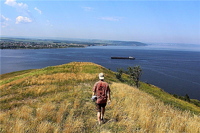
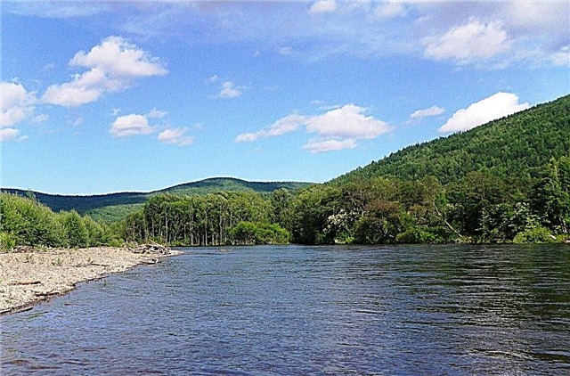
In terms of water supply, the Khabarovsk Territory occupies one of the leading places in the country. Most of the rivers are small. The sources of many rivers are located in the mountains and flow in narrow valleys - because of this, they have a fast flow in the upper reaches. When descending into the plains, the current is calm, and the valleys become wider. The banks of a large number of rivers are sparsely populated and have virgin wildlife.
Some of the rivers pass through the territories of wildlife sanctuaries and reserves. Water tourists traveling along the rivers of the region will see the unique flora and fauna. Among the inhabitants of the forests, there are animals listed in the Red Book. The forests themselves are diverse - there are both deciduous and coniferous trees on the banks of the rivers. A special value of the regional rivers is the abundance of commercial salmon fish. The pride of the Khabarovsk Territory is the Amur River, passing along the border with the PRC.
The longest rivers of the Khabarovsk Territory
List of the largest rivers flowing in the region.
Amur
Ranks tenth in the world among rivers in terms of water basin area. The ichthyofauna of the Amur is the most diverse in the Russian rivers - 108 species of fish live in it. Thousands of tourists come to the river for fishing opportunities and beautiful scenery. It flows in the Khabarovsk and Trans-Baikal Territories, the Amur and Jewish Autonomous Regions, as well as through the Heilongjiang Province in the PRC and Mongolia.
The total length of the river is 2824 km.

May
The tributary of the Aldan, into which it flows upstream. A beautiful river, whose winding bed passes through picturesque places surrounded by mountains and ridges. Its inaccessibility makes its tourist development difficult, but it is popular with rafting and anglers. There are pebble rifts and channels along the entire channel. It flows through the Khabarovsk Territory and the Republic of Yakutia.
The total length of the river is 1053 km.

Ussuri
It originates on the slopes of Snezhnaya Mountain. Basically, the river is flat, with branches and islands, but in the upper reaches it is a typical mountain river. The river is under ice from November to April. The river is home to a wide variety of fish, more than 20 species. Partially navigable, used by tourists and sportsmen for rafting. The Russian-Chinese border runs along a large stretch of the river. It flows through the Khabarovsk and Primorsky Territories.
The total length of the river is 897 km.

Uchur
The river bed runs through mountainous terrain among deserted and remote places. There are only rare hunters' houses. On its shores you can find bears, elk and reindeer. Berries and mushrooms grow. Taimen, burbot, grayling, sturgeon are found in clear water. The flow of the river is fast. Rafting on the river usually takes 3-4 days. It flows through the Republic of Yakutia and the Khabarovsk Territory.
The total length of the river is 812 km.

Yudoma
Tributary of the Maya River. The source is located on the Suntar-Hayatha ridge. In the upper reaches of the river, the banks are steep and steep, the current is fast. There are many rapids, shoals and pitfalls in it. There are many lakes of different sizes in the middle of the river valley. During floods, the river floods the valley at the mouth. It is navigable in a section of 200 km. It flows through the territory of the Republic of Yakutia and the Khabarovsk Territory.
The total length of the river is 765 km.

Amgun
Amur tributary. It flows through areas of permafrost and wetlands. The great honor of salmon fish of the Amur basin comes to Amgun for spawning. Migratory routes for migratory birds pass through the river valley. In addition to cranes and ducks, here you can see birds listed in the Red Book - dry-billed and mandarin duck. On the banks of the river, hunting and fishing are popular, as well as viewing outlier rocks and waterfalls.
The length of the river is 723 km.

Bureya
The Amur tributary flows through the Amur Region and the Khabarovsk Territory. In the upper reaches it is a mountain river, further - a flat one. The name in the language of the Albazin Cossacks means "assertive, impudent". Rafting along its dangerous course is not recommended for untrained people. In the Bureya basin, gold is mined, there are deposits of coal and iron ore, a powerful Bureya hydroelectric power station has been built. Reserves and a wildlife sanctuary have been organized.
The total length of the river is 623 km.

Allah Yun
It flows through Yakutia and the Khabarovsk Territory. There are gold deposits in the river basin. The picturesque river is of interest to water tourists - the river bed is wide, there are simple rapids. The rafting route is from 205 km to 355 km. On the reaches, a weak current can become an obstacle. The banks of the river are covered with mixed forest, there are open and rocky areas, in the lower reaches there is a swampy area.
The total length of the river is 586 km.

Bikin
It flows in the Khabarovsk and Primorsky regions. The banks of the river are inhabited by the indigenous people of the Far East - the Udege. The nature around the river valley is diverse - peat bogs, an array of virgin broadleaf and cedar forests. Rare animals, for example, the Amur tiger, and birds live here, unique plants grow. In 2018, UNESCO took the Bikin River valley under its protection.
The total length of the river is 560 km.

Urmi
It flows through the Jewish Autonomous Okrug and the Khabarovsk Territory. On a section of 260 km it is suitable for rafting. The most interesting rafting is in the upper reaches of the river - there it flows in the mountainous area, there are few rapids and other difficult areas. The lower reaches of the river are located among larch forests. Urmi is also of interest to fishermen - grayling, chum salmon, lenok, crucian carp, ide are found in it. There are more than 1000 lakes in the river basin.
The total length of the river is 458 km.

Uda
The river basin is inaccessible and sparsely populated. The mouth of the river is located near the village of Chumikan, its inhabitants live by trades - reindeer husbandry, fishing, hunting. Representatives of salmon species enter the river for spawning. It is rich in taimen, grayling, pike. This attracts fishing enthusiasts to the shores of Uda. The river is not suitable for rafting - it is impassable in low water and dangerous in high water. The current is fast.
The length of the river is 457 km.

Chorus
One of the most accessible rivers of the region - you can get almost to the very source in the mountains. Travelers go there to get acquainted with the amazing nature of the Far East, admire picturesque places, and relax away from civilization. The fauna of this place is diverse. You can find red deer and roe deer. Flocks of wild ducks often swim by the fishermen's boats. The water of the river is clean, there are large pebble spits.
The length of the river is 453 km.

Chur
Mountain river, its source is located on the Badzhal ridge. Tourists should be careful - wild animals live on the banks of the river - roe deer, bears, otters, hares. The landscapes of nature are mesmerizing, the waters of the river are abundant in fish. It is inhabited by grayling and lenok. Sports fishing lovers can catch taimen. The rapid mountain course of the river becomes calm in flat terrain. Mixed forests give way to meadows.
The length of the river is 434 km.

Algama
It originates on the slope of a mountain range and has the features of a mountain river along its entire length. Only in the lower reaches its width reaches 150 meters. In Evenk “alga” means “blessing”. It freezes in October and remains in ice until May. The river is used by tourists and sportsmen for rafting. There are about 1,500 lakes in the river basin, the most beautiful of them is Bolshoye Toko, located on the border of the Khabarovsk Territory and Yakutia. It is called Far Eastern Baikal. The river flows through Yakutia and the Khabarovsk Territory.
The total length of the river is 426 km.

Maimakan
It flows in a valley between mountain ranges in a northern direction. In the past, Evenks lived on the river, gold prospectors worked. Bears, elks, sables live in the forests on the banks of the river. The river is inhabited by salmon and taimen. Tourism is developed on Maimakan. Fishermen, water tourists, and lovers of recreation in the wild come here. The harsh nature of the river banks is incredibly picturesque.
The length of the river is 421 km.

Ulbey
The source of the river is in the mountains, Ulbeya flows into the Sea of Okhotsk. Formed by the confluence of the Granitny and Goria keys.Salmon enter the river to spawn, and wild animals live on the banks. Tours for hunters and fishermen are organized in the river valley, mainly in summer. The banks of the river are covered with larch and cedar forests. The river has many tributaries of its own of varying lengths.
The length of the river is 399 km.

Anyui (tributary of the Amur)
A beautiful river that flows through the territory of the Anyui National Park. In the upper reaches, the river has a mountainous character, in the lower reaches, on flat terrain, the current is calm. The river valley is wide, the low banks are partly swampy. The natural landscape is diverse - mixed forest, mountain tundra, rocks, relief cliffs, natural monuments, waterfalls. The banks of the river are sparsely populated.
The length of the river is 393 km.

Hunting
It flows through the mountain ranges and flows into the Sea of Okhotsk. The banks of the river are almost completely covered with forest. The lumber industry uses the river for rafting forests, the lower reaches of the river are navigable. Valuable fish species spawn in the waters of the river. The first Far Eastern settlement, Okhotsk, is located at the mouth of the river. Okhota has quite large tributaries with a length of more than 300 km.
The length of the river is 393 km.

Gorin
Also known under the names Goryn, Goryun, Garyn. The Komsomolsk State Reserve is located on the territory of the lower reaches of the river. Because of the picturesque places, the Gorin River is called one of the most beautiful rivers in the region. Ash, Korean cedar, elm, and fir grow in the reserve. Sable, roe deer, wild boar live. In ancient times, an ethnic group of the Gorin Nanai, the Samagirs, lived in this place.
The length of the river is 390 km.

Kukhtui
The source of the river is on the Suntar-Khayakhta ridge near the border with Yakutia. Kukhtui flows into the Sea of Okhotsk. The banks are covered with forest practically along the entire length of the river. The Ozerny ornithological reserve is located in the river basin. The waters of the river are transparent, it is home to a large number of different species of fish. Coho salmon enters its waters for spawning. Kukhtui is a navigable river and is used for timber rafting.
The length of the river is 384 km.

Kulu
It flows in the permafrost zone through the territories of the Magadan Region and the Khabarovsk Territory. In summer, Kullu is popular with water tourists. The banks of the river with wild nature are incredibly picturesque. The depth of the river in the reaches reaches 4 meters, on the rifts no more than 0.7 meters. In winter, winter roads are laid on the frozen river bed. It flows into the Kolyma River.
The total length of the river is 384 km.

Taui
It flows through the Magadan Region and the Khabarovsk Territory in places with a harsh climate and cold stormy winds. In winter the temperature reaches -45 ° С, in summer the average temperature is + 12 ° С. It flows into one of the bays of the Sea of Okhotsk. The river has more than 50 tributaries ranging in length from 3 km to 300 km. Grayling, salmon, smelt, and coho salmon enter the clear clear water for spawning in the river.
The total length of the river is 378 km.

Tumnin
The river has a mountainous character almost along its entire length. In the lower reaches it forms several creeks and branches, the current is calm. A mixed forest and light-coniferous taiga grow along the banks. On the left bank of the river is the Tumninsky reserve - the nature in it is picturesque and unique. It is home to a large number of animals, including rare species - white-tailed eagle, peregrine falcon, Amur tiger, black crane.
The length of the river is 364 km.

Niemann
It flows through the Khabarovsk Territory and the Amur Region. The river begins on the Izop ridge - the upper course of the river is stormy and impetuous, in several places the rapids rise above the water. Larch trees - aspen, birch, poplar - grow along the banks of the river along its entire length. There are fish typical for the Amur basin - grayling, taimen, pike. Gold mines are being developed in the tributaries of the river.
The total length of the river is 353 km.

Gur (tributary of the Amur)
The source is located on the slopes of the Sikhote-Alin volcanic field. In the upper reaches, the river is slightly meandering, with rare islands. In the lower reaches, the Gur flows through the lowlands, the banks are swampy. The river is of great importance for fishery - chum salmon, salmon and pink salmon spawn in it. Rafting on the river belongs to the category of light and is popular with novice water tourists. The complexity is caused by the rapid flow.
The length of the river is 349 km.